
Neighborhood History: Rosedale
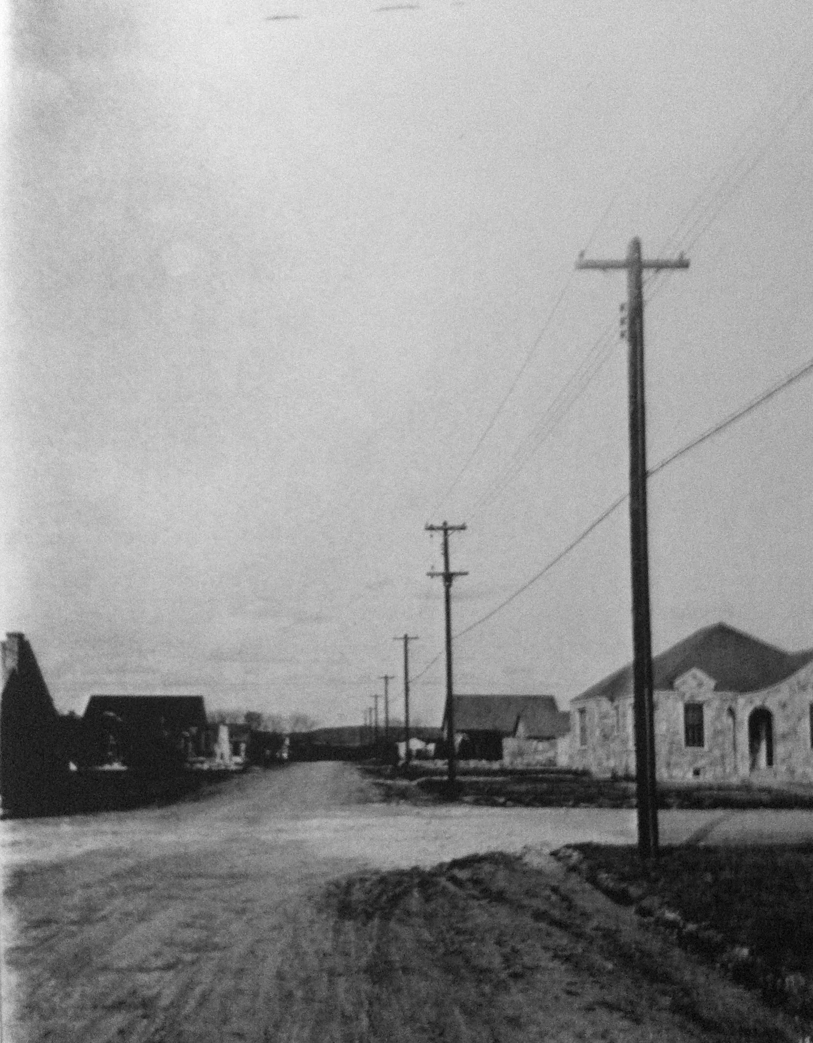
1937 Rosedale: Community infrastructure being installed.
BY SARAH RODRIGUEZ
Rosedale’s Early Residents - 1838
The first permanent housing in the Rosedale neighborhood occurred only a few short years after the Republic of Texas was established in 1836. (Platting the Rosedale neighborhood didn’t come until the 1890s.) The newly-created Texas Land Office awarded a large parcel of land, which included Rosedale, to George W. Spier in 1838 as a part of the headright land grants. Already established in Fayette County, Spier split up the land and sold it to five different individuals: brothers Thomas and David Adams, John Hancock, Gideon White and Norman Wood. Gideon White, an Alabama native, bought the majority of land that now constitutes the Rosedale neighborhood.
“The Republic of Texas made many headright grants, that is, grants given on the condition that specified requirements be met by the grantees. Under the Constitution of 1836 all heads of families livingin Texas on March 4, 1836, except Africans and Indians, were granted “first class” headrights of one league and one labor (4,605.5 acres), and single men aged seventeen years or older, one-third of a league (1,476.1 acres).”
Shortly after purchasing the land, White built a double pen dog-run log house for his family, including his wife, five daughters and eight slaves. Originally grassland, White used the land to graze his cattle. Living on largely unsettled land was not without its dangers. In 1842 White was killed by what was described as a band of Waco Native Americans. After his death, the land passed to his five daughters. White’s two older daughters, Cornelia Jane Johnson and Elizabeth Ann Moore, inherited land north of what is now 40th Street. The three younger daughters, Louise Maria Seiders, Rebecca Caroline Thompson and Narcissa Lucinda Fisk, inherited land south of 40th Street.
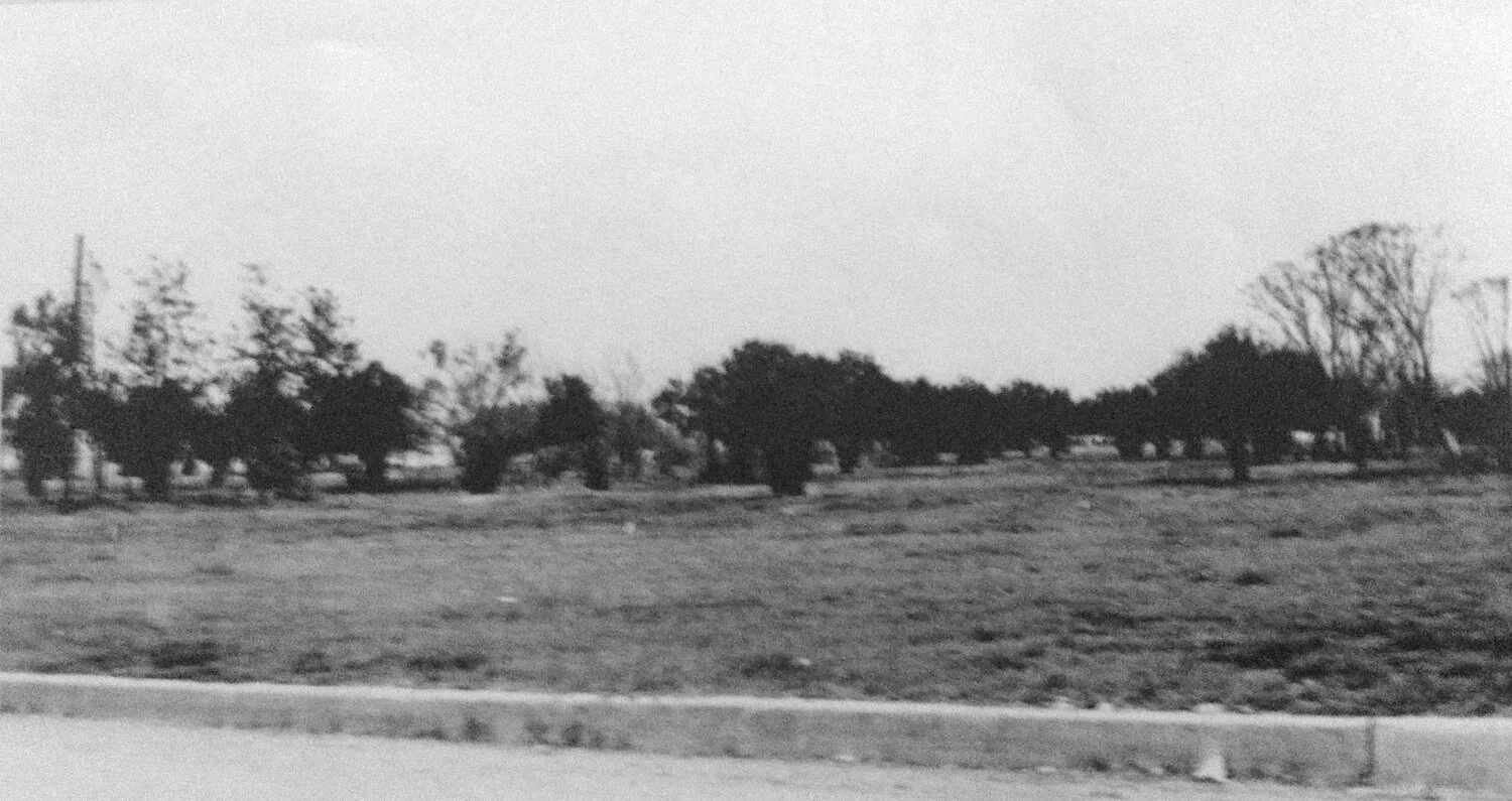
Rosedale’s Ramsey Park in 1941
Although White’s land was divided into several parcels, the land was eventually split between two families, the Sieders and the Hancocks. Land below 40th Street was consolidated into Edward Sieders holdings. He was a former partner of Gideon White who married White’s daughter, Louise. Brothers George and John Hancock bought the rest of White’s land, the majority of which was north of 40th Street.
The Hancocks and Sieders each had different plans for their respective properties. In 1870 the Hancock brothers established a small dairy farm on the land; it would continue dairy production until about 1900. Dairy farming in Rosedale would continue until 1940.
The Seiders family developed their land growing various cash crops. Rosedale continued to be largely agricultural until 1890, when three parcels of land were subdivided to provide housing.
Historically, there are more than 20 documented subdivisions in Rosedale, the earliest of which were built in 1890. Edward Seiders’ son, Henry, an independent New York developer named E.J. Heppenheimer and an independent freelancer, George Penn, planned the first three subdivisions. Both Heppenheimer and Penn had bought land from the Edward Sieders’ descendants, although Heppenheimer resold the land barely ten years later after the Austin dam failure of 1900.
Two more subdivisions were platted during the 1890s. One subdivision, by another one of Edward Seiders’ sons, Ed, was platted in 1892. The subdivision ran “along 38th (Spring) Street from Lamar to one lot west of Medical Parkway but only.” The second subdivision was subdivided by Lewis Hancock and “ran from Burnet Road east to Medical Parkway, from 45th nearly to 40th Street.” A majority of these subdivisions were bought plot-by-plot by individuals, who then constructed their own houses.
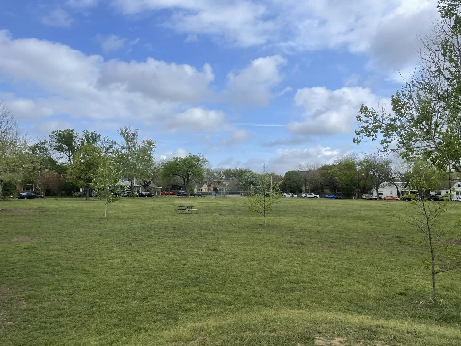
Ramsey Park, 2021
Groceries, Nurseries and Carnations
Subdividing the land for housing slowed at the turn of the 20th century, but commercial and agricultural activities “bloomed” from 1900 to 1910. The Ramsey Nursery, which had originally operated in Burnet County, moved to Rosedale in the early 1900’s. The nursery grew a wide variety of trees, shrubs, ferns, and flowers, and was a major job creator for the area. Arthur Seiders, a celebrated gardener, built Sieders Florist in the 1900’s along West 38th Street just north of North Lamar. His nursery was the first in Austin to grow carnations. The Ramsey Nursery and Seiders Florist encouraged several other gardening and florist shops to open in Rosedale during the 1920s and 1930’s. Rosedale was also home to Harrison Grocery Store. Built in 1909, Harrison’s Grocery was one of the earlier corner stores to open in the neighborhood after Payne’s Grocery Store. James Harrison and his family operated the grocery until 1917, when Solon Costley and his family bought the store. The Costleys operated the store until 1926, selling groceries, dry goods and other confectionaries. This new economic activity spurred new subdivision activity in Rosedale.
Three subdivisions were platted in Rosedale between 1910 and 1920. The first subdivision was plotted “from 39-1/2 almost to 39th Street, from Bailey Lane to Shoal Creek.” The second subdivision, called Lee Hill, was mapped by out by F.T. Ramsey, owner of Ramsey Nursery, and “ran from Medical Parkway east to Lamar, from 40th to 42nd” street. Walter Benson and Houghton Brownlee mapped out Alta Vista, the final subdivision of the decade in 1918. Alta Vista covered more than 11 blocks and 200 lots and ran from “42nd Street to 45th Street between Lamar and Medical Parkway.” After the parceling and sale of these three areas, the plotting of subdivisions ground to a halt for a decade.
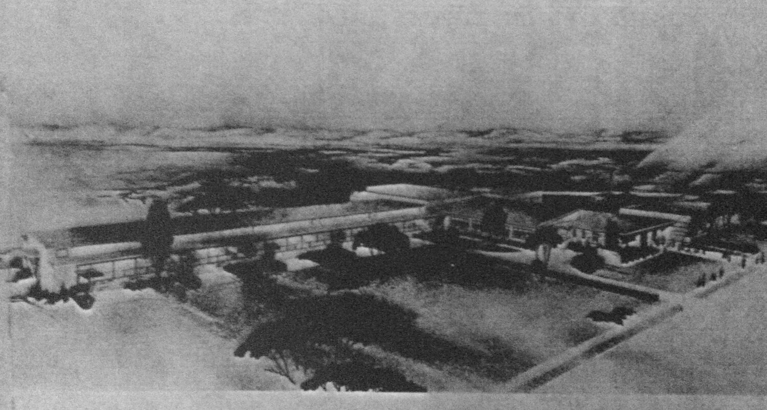
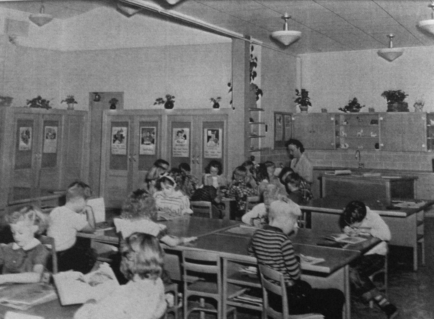
Rosedale Elementary School, 1948
In the 1930s and 1940s, Rosedale construction began in full force. While the rest of the U.S. was devastated by the Great Depression, Austin fared better, especially in the housing market. Individuals and construction companies invested in housing in Rosedale. Built during the Depression, houses that still exist from this period are compact and reflect the spendthrift attitude of the time. The first wave of subdivisions, platted by the Ramsey sisters, Jessie, Winnie and Ellen from 1931 to 1938, were a combination of land inherited from their father, F.T. Ramsey and land bought from other owners such as the Wallis family. The sisters also donated and sold various parcels to the City of Austin, which were consolidated into Ramsey in 1934.
In 1935, the Austin Realty and Investment Company platted a second subdivision that ran “from North Loop south to 49th Street, and from Burnet Road west to...the back of the Creekside Apartment property.” The Melrose Terrace was platted by Cordelia Assmann and was composed of “55 lots running 5 and 6 lots north and south of 46th Street from Burnet Road to halfway between Ramsey and Sinclair.” The Shoalmont Addition was parceled out two years later by Adolph Kohn and extended from “Shoal Creek east to an irregular line now forming the back of the Creekside Apartments property, Hancock Drive to 49th/Crestmont.” The last subdivision platted in the 1930’s was plotted by F.W. McGuire, a dairy farm owner. His dairy operation was one of the last to operate in Rosedale. The dairy included 75 lots that “ran from 40th Street to 42nd Street and from Shoal Creek Blvd. east to halfway between Ramsey and Rosedale.
Rosedale Elementary School in the 1960s
Only three subdivisions were built during the 1940s: Rosedale Estates, Tonkawa Bluff and Shoalcrest Oaks. Rosedale Estates was the final subdivision to be designed by any of the Ramsey sisters; it was bounded by “49th Street south to just past 46th Street and from halfway between Shoalwood and Woodview/ Shoal Creek Blvd. to Shoal Creek.
Tonkawa Bluff was plotted by Frederick Eby Jr., ran “from one lot east of Bailey Lane to one lot west of Tonkawa Trail, and from 38th almost to 39th 1⁄2 Street.” Gordon H. Lloyd, the designer of the Texas State Employees Retirement System and State Highway employee, plotted the Shoalcrest Oaks, which ran “between 39th 1⁄2 Street and 40th Street from just east of Bailey to just west of Shoal Creek Blvd.” The development of subdivisions continued from the 1940s to the 1960s, before stopping for a decade in the 1970s, then continuing in the 1980s and 1990s.
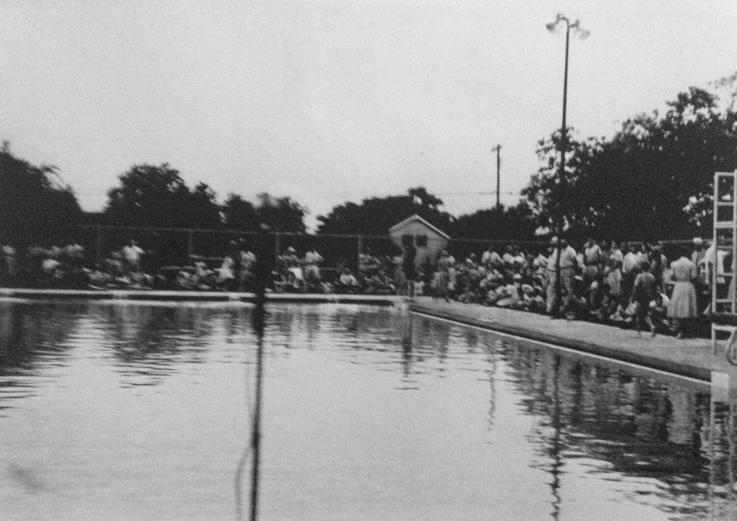
Ramsey Park’s pool in 1956
Several designated historic properties are in Rosedale’s boundaries, although most are below 45th Street. Samples of Rosedale’s historic structures can be traced to the mid-1800s. The Moore-Hancock Farmstead is one of the earliest surviving structures, and although it has been altered it represents “a rare surviving example of local pioneer farmstead architecture.” Located at 4811 Sinclair, the farmstead was built by Martin and Elizabeth Moore, and later owned by James Hancock and his family. Restoration occurred after the property was condemned by the city in the late 1980’s. The majority of historic houses that still exist today in Rosedale are Depression-era houses, built between the 1930s and 1940s. Although many Rosedale homes have been demolished or severely altered, the neighborhood still boasts a wide portfolio of architectural styles such as Colonial and Tudor Revivals, Ranch houses, Cottages and Bungalows. The variety of Rosedale’s architectural styles is a result of the diversity brought by craftsman, homeowners and Austin lumber companies. Today’s Rosedale faces substantial development pressure along the Burnet/North Lamar corridor. Fortunately, a number of Rosedale residents, past and present, are fighting to document and preserve the history of the neighborhood.
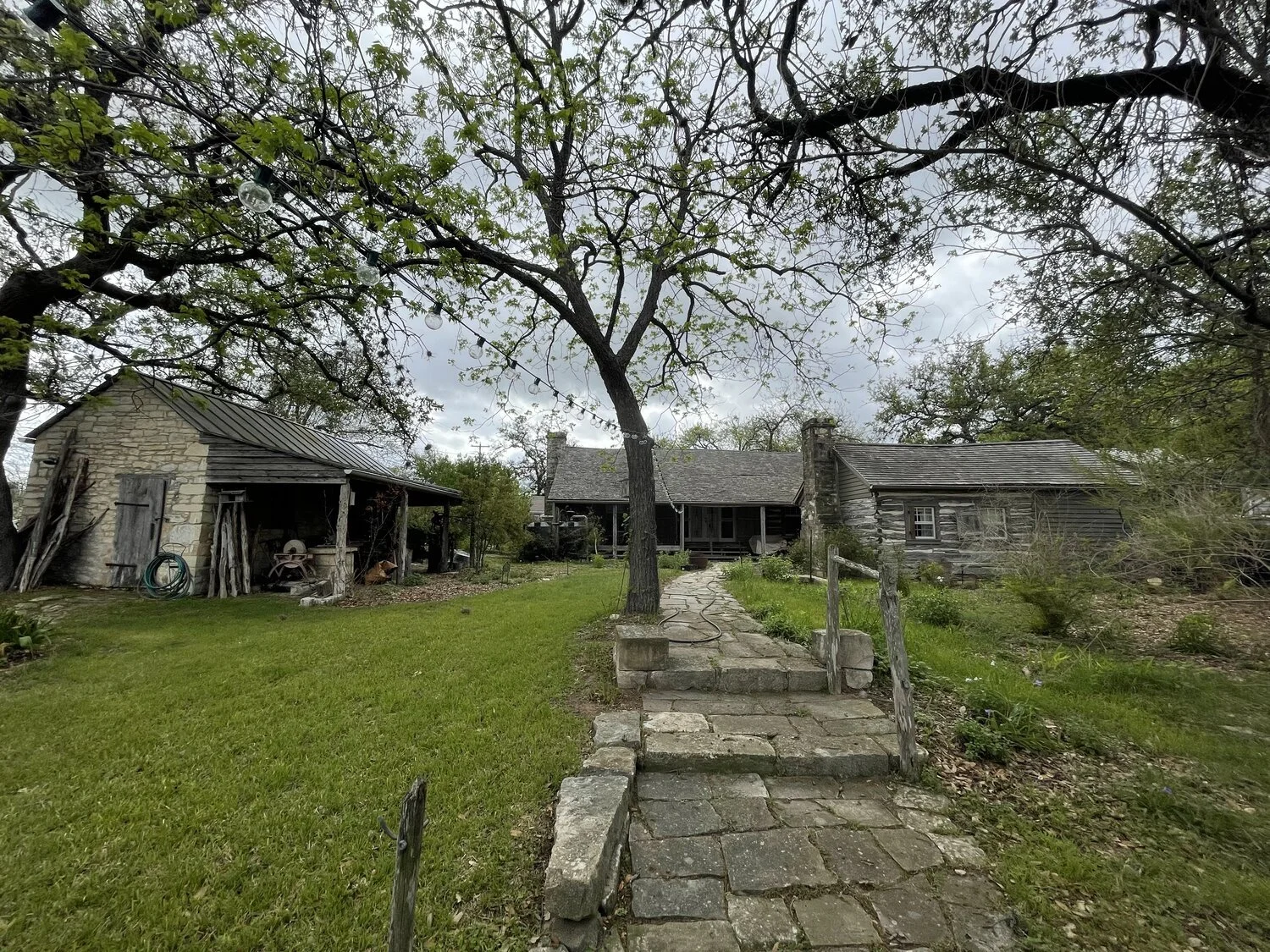
Moore-Hancock Farmstead 4811 Sinclair, (present day)
THIS ARTICLE WAS WRITTEN FOR PRESERVATION AUSTIN’S WINTER 2015 NEWSLETTER. READ OUR COMPLETE NEWSLETTER ARCHIVE HERE.